When a structural engineer designs a building in Rhode Island to resist wind loads, the starting point is not just the wind speed — it is also the building's exposure category. A home sitting behind dense suburban tree cover experiences wind differently than an identical home sitting on an open coastal bluff. ASCE 7-16 — the wind-load engineering standard referenced by the Rhode Island State Building Code — captures this difference through Exposure Categories B, C, and D.
Why Exposure Category Matters
Two buildings on the same street, designed for the same Risk Category II wind speed (Vult), can have substantially different design wind pressures if they sit in different exposure categories. Exposure Category D generates higher pressures than Exposure C, which in turn generates higher pressures than Exposure B. The practical effect is larger structural members, stronger connections, more hold-downs, and — in coastal Rhode Island — the difference between prescriptive and engineered design paths.
Exposure category is a site characteristic, not a building characteristic. Two identical houses on opposite sides of Route 1 in Matunuck may fall into different categories — and be engineered to different pressures — based on the upwind terrain each faces.
The Three Categories
Exposure Category B
Applies in urban and suburban areas, wooded areas, or other terrain with numerous closely spaced obstructions having the size of single-family dwellings or larger. The wind arrives at the site having been slowed and roughened by those obstructions.
Exposure Category C
Applies in open terrain with scattered obstructions having heights generally less than 30 feet, including flat open country and grasslands. This is the default category for most of Rhode Island away from the coast — including most of the Blackstone Valley, the inland portions of Washington County, and the rural reaches of the state's western towns.
Exposure Category D
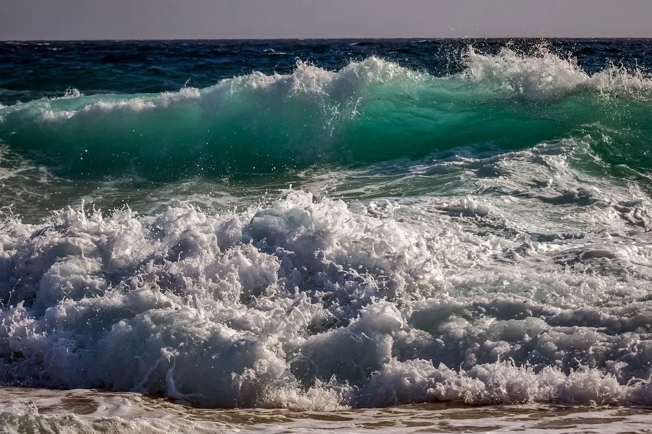
Applies to flat, unobstructed areas and water surfaces — smooth mud flats, salt flats, unbroken ice, and ocean or bay frontage where wind arrives over a long reach of open water. This is the most severe category and produces the highest design wind pressures.
How the Category Is Determined
ASCE 7-16 §26.7.3 determines exposure category by looking upwind from the site. The surface roughness that prevails in the upwind direction — for a defined distance — governs the classification.
For Exposure B (for buildings with a mean roof height ≤ 30 ft): Surface Roughness B must prevail in the upwind direction for a distance of at least 1,500 feet. If a site is nominally in Exposure B terrain but sits within 1,500 feet (or 10 × building height, whichever is greater) of an Exposure C or D condition upwind, the site must be treated as the more severe exposure.
For Exposure D: Surface Roughness D must prevail in the upwind direction for a distance of at least 5,000 feet (1,524 m) or 20 × building height, whichever is greater. Once Exposure D is established at a qualifying shoreline, it extends inland for a further 600 feet (183 m) or 20 × mean roof height, whichever is greater. Beyond that distance, the site transitions to Exposure C.
Exposure C is the catch-all: it applies where neither B nor D applies.
Two Distance Values to Remember
For most residential and light commercial structural design in coastal Rhode Island, two distances do the heavy lifting:
| Distance | What It Governs |
|---|---|
| 5,000 feet | Minimum upwind open-water fetch required for Exposure D to apply |
| 600 feet | How far Exposure D extends inland from a qualifying shoreline (or 20 × mean roof height) |
A home 500 feet inland from Narragansett Bay, with the bay providing 5,000+ feet of open-water fetch upwind, is in Exposure D. The same home 800 feet inland — beyond the 600-foot extension — is in Exposure C, despite being within sight of the bay.
Rhode Island Locations in Each Category
Exposure Category B
Dense residential and commercial areas where closely spaced buildings, trees, or other obstructions provide upwind roughness for at least 1,500 feet:
- Providence and Cranston proper
- The dense residential sections of Pawtucket, Central Falls, and Woonsocket
- Kingston village (the URI campus area, where campus buildings and mature tree canopy provide obstructions)
- Wakefield village and Peace Dale commercial/residential cores
Exposure Category C
The default for most of Rhode Island where neither B nor D applies:
- Most rural and suburban terrain in Washington, Kent, and western Providence counties
- Inland South Kingstown (West Kingston, Tuckertown, Usquepaug, Perryville) beyond the 600-foot coastal extension
- Open farmland throughout the state
- Most of Little Compton, Tiverton, and rural Newport County away from the coast
Exposure Category D
Rhode Island's coastal sites and larger bodies of water where the 5,000-foot upwind-fetch test is met:
- Open Atlantic coast: Westerly (Misquamicut, Watch Hill), Charlestown (Charlestown Beach, Green Hill), South Kingstown (Matunuck, East Matunuck, Moonstone Beach), Narragansett (Scarborough State Beach, Galilee, Bonnet Shores), Newport (Brenton Point, Ocean Drive, Ruggles Avenue), Middletown (Second Beach, Third Beach, Sachuest Point), Little Compton (South Shore Beach, Warren's Point), and New Shoreham (all of Block Island)
- Narragansett Bay frontage: Portsmouth, Bristol, Barrington, Warwick, East Providence along the bay shore
- Mount Hope Bay frontage: Tiverton, parts of Bristol
- The larger coastal salt ponds: Ninigret Pond (Charlestown), Winnapaug Pond (Westerly), Green Hill Pond and Potter Pond (South Kingstown) where fetch direction and pond geometry produce 5,000+ feet of open water
How Exposure Category Interacts with the Wind-Borne Debris Region
Exposure category and the Wind-Borne Debris Region (WBDR) are different rules, with different distance thresholds, addressing different hazards:
- Exposure category governs the wind pressure the structure must resist. Exposure D produces higher design pressures than Exposure C.
- WBDR governs whether openings must be protected against flying debris. Inside the WBDR, windows must either use impact-resistant glazing or approved shutters — otherwise the structure must be designed as partially enclosed, which further increases wind loads.
The WBDR applies within 1 mile of the "mean high coastal water line" where the Risk Category design wind speed exceeds 130 mph. So it is possible — and common in coastal Rhode Island — for a site to be:
- Inside the 1-mile WBDR zone (impact-resistant glazing required) but outside the 600-foot Exposure D zone (designed to Exposure C wind pressures)
- Inside both zones — the typical condition for homes within a few hundred feet of the ocean or a large bay
Each rule must be assessed independently at the specific site.
What This Means for Your Rhode Island Project
If your property is coastal or near a large water body, an engineer designing to the Rhode Island State Building Code should:
- Determine the applicable Risk Category (II for most residences; III for larger assembly, schools, and certain healthcare; IV for hospitals, fire stations, and essential facilities)
- Query the ASCE 7-16 Hazard Tool at the actual site coordinates for the site-specific Vult
- Assess the upwind surface roughness across at least 5,000 feet in each of four quadrants to determine Exposure Category
- Check the 600-foot inland extension if within 1,500 feet of a qualifying Exposure D shoreline
- Check the 1-mile WBDR zone if within 1 mile of the coastal mean-high-water line
- Design to the applicable exposure category and, if in the WBDR, specify impact-rated openings or a partially-enclosed design
For a complex coastal site — salt-pond frontage, irregular coastline, borderline fetch conditions — these assessments can materially change the structural design. Getting them right at the outset saves costly changes during construction and protects the structure's performance through its service life.
For an application of this framework to a specific Rhode Island town, see Structural Engineer Serving South Kingstown, Rhode Island.
About the Engineer
Kenneth A. Hayes, P.E.
Principal engineer of South County Design Group, Inc. Practicing structural engineering in Rhode Island since 2003. Focus areas include coastal residential structural engineering, elevated coastal construction, wind-load analysis, and FEMA floodplain compliance.
- License: Rhode Island Professional Engineer #7252
- Alumnus: University of Rhode Island
- Office: 375 Oakwoods Drive, Wakefield, RI 02879
- Phone: (401) 792-3933
- Email: southcountydesigngroup@cox.net
Questions About a Rhode Island Coastal Project?
For engineering inquiries on residential or commercial projects in Rhode Island's coastal towns.
Contact South County Design Group